In the 14 years since my first overnight motorcycle trip, I've found one of my favorite aspects of motorcycle touring is stumbling upon oddball things along the way. It really adds to the "exploration" aspect of touring when you see something that's so interesting — or unusual — that you feel compelled to turn around and take a closer look.
I have yet to ride the famous old U.S. Route 66, which I'm told has its fair share of unusual landmarks, but in the about 150,000 miles I've logged on two wheels in 30 states, a few roadside oddities really stand out. Here are five of my favorites.
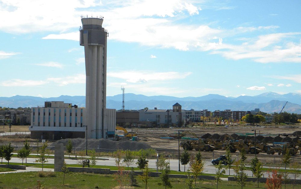
Former Stapleton Airport tower
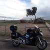
Imagine walking out your front door and taking in the sight of an abandoned air traffic control tower rising in the middle of your neighborhood. For residents in one Denver housing development, that's an everyday occurrence.
The tower was part of the former Stapleton International Airport that was closed in 1995. The land was redeveloped with New Urbanist-style housing and commercial and retail development and is now called Central Park, but the about 160-foot-tall tower still stands. Its lower levels have been converted to a restaurant and arcade.
I first saw the tower in 2011 after learning about Stapleton's history while I was earning a graduate degree in urban planning. At that time, the tower was unoccupied, standing in an empty, muddy field. My second visit was eight years later, and that empty, muddy field was then occupied by a parking lot and a few dozen homes.
Though the scale of the tower is imposing as you ride toward it, the contrast between its former and current uses is what I found most striking. At an active airport in a post-9/11 world, the general public can't go anywhere near an air traffic control tower. At Stapleton, you can park right next to it, walk inside and order a burger and a beer.
The tower is located at 3120 Uinta Street on Denver's north side, about three-quarters of a mile south of I-70.

Tree in the Rock
My girlfriend, Amanda, loves to make fun of this site. "It's literally just a tree in a rock," she says. Yes, it's a tree that's growing out of solid rock and has been doing so since at least the 1800s.
According to the plaque affixed to the boulder that serves as the tree's base and a nearby information sign, railroad construction crews came upon the Tree in the Rock while building the Union Pacific Railroad's mainline in 1868. The railroad provided steel cables to help hold the rock together. The sign also says this species of tree (a Pinus flexilis) can live for a millennium or two.
The railroad was later rerouted to the south, and the right-of-way was repurposed for the Lincoln Highway and later the westbound lanes of Interstate 80. The eastbound lanes were built north of the landmark, leaving the Tree in the Rock in the interstate's median.
I first spotted the Tree in the Rock on my first cross-country motorcycle trip in 2010. I was en route from Buffalo, New York, to Salt Lake City for the FIM World Superbike round at what was then known as Miller Motorsports Park. I was riding eastbound on I-80 and was in the right lane when I noticed the peculiar sight. There was a car to my left, and I didn't have enough time to slow down to exit left off the freeway to the parking area by the tree. But I decided I was going to check it out on the way back east.
A few days later, I made sure I was in the left lane after I passed through Laramie, Wyoming, and stopped at the Tree in the Rock for the first time. It’s a simple yet perplexing landmark. It's a lone, underdeveloped tree, but there's something inspirational about seeing a tree grow in such an inhospitable spot. Others must have the same feeling because the Tree in the Rock has been a stop for travelers for so many years by train or by road.
I've seen it two more times since, once on a motorcycle trip in 2019 and once while my girlfriend and I were driving my sister's car back to upstate New York when she moved in 2017. Amanda's lack of enthusiasm for the site may have something to do with the license plate coming loose from my sister's car right after we visited the tree and the mild chaos that ensued until we made it back to New York.
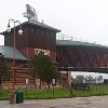
The Archway Museum
This isn't an ordinary museum. It's not built next to an interstate. It's built over one — as in directly above Interstate 80 just east of Kearney, Nebraska.
The museum was built in 2000 and tells the story of American western migration and settlement in the Platte River region. According to the National Park Service, the Archway building is about 300 feet long and the interstate it spans was once part of the Oregon Trail and Lincoln Highway.
You enter the museum at ground level and, after purchasing admission, head up to the two-story museum space. You can tell how far along you are in the exhibit by the curvature of the floor. Using a mixture of props, artifacts, storyboards, and more, the exhibits present a broad yet detailed, succinct, and balanced view of American emigration from the east through central Nebraska from pre-European settlement to modern times. As someone who has taken graduate-level coursework in museum studies and who volunteers at a museum, I really enjoyed the exhibit. Plus, there's even more to see on the museum's grounds beyond the Archway, including a sod house and some outdoor artwork.
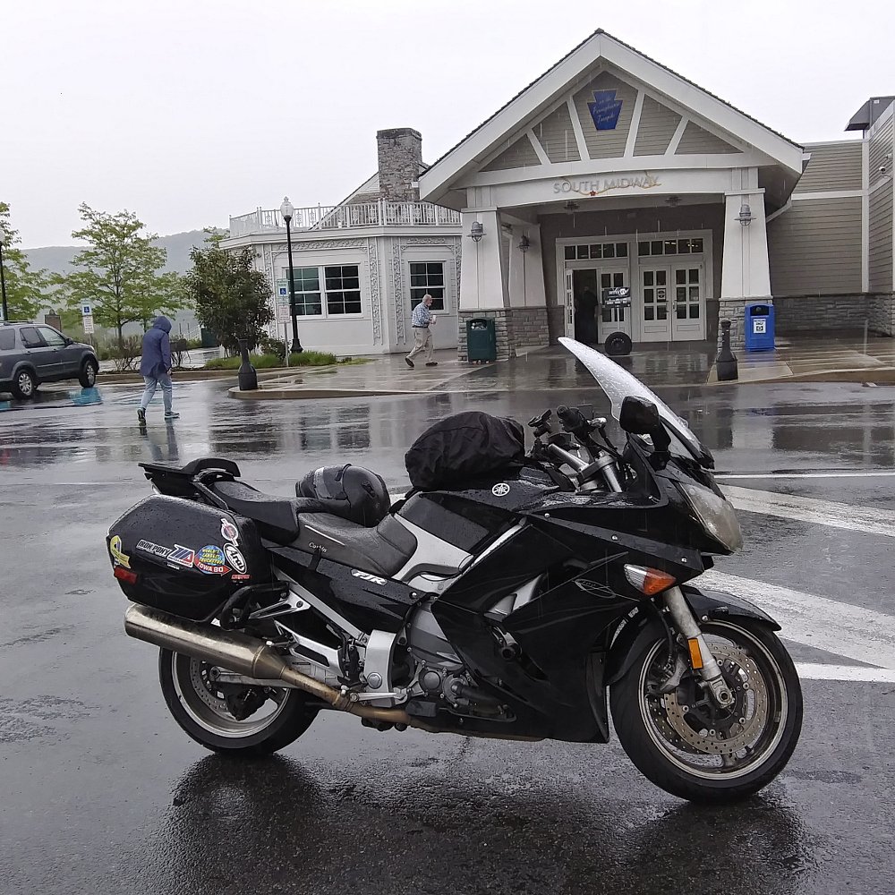
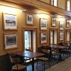
Midway Service Plaza, Pennsylvania Turnpike
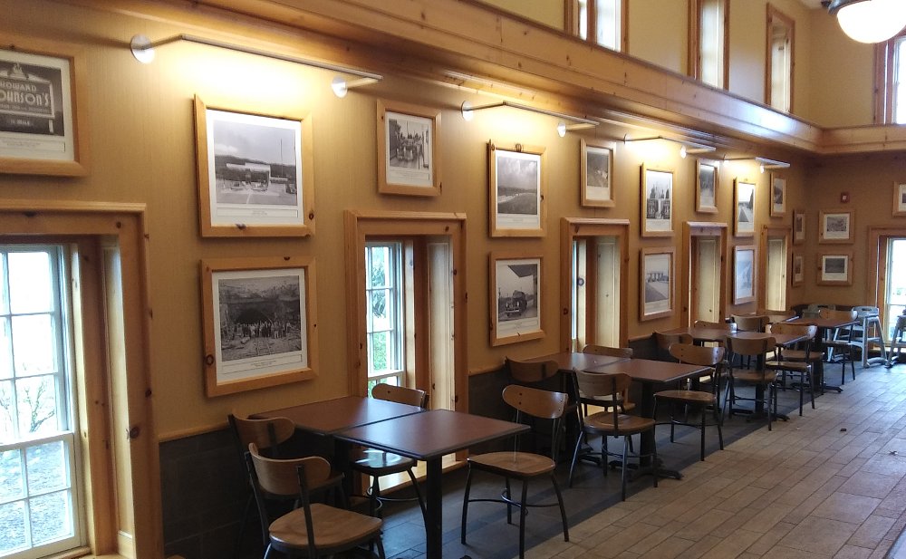
What could be exciting about a toll road service plaza? The facility was heavily remodeled on the inside and expanded in the 2010s and some aspects of the original architecture were either saved or mimicked. Its exterior is a bit more ornate than most service plazas. But what makes this a roadside gem is the collection of photographs throughout the dining area that showcases the turnpike's construction and operating history.
While you can enjoy some fine Roy Rogers, Auntie Anne's, or Sbarro in the dining hall, take some time to walk around and see how an abandoned railroad project and its several tunnels were converted to a superhighway from the 1930s to the 1950s. There's also a glass case that contains artifacts from the turnpike's past, and large-print engineering drawings of the original Midway service plazas are on display. The plans show the underground tunnel that once connected Midway South to its sister plaza (Midway North) on the other side of the turnpike right-of-way.
The plaza's name, Midway, is due to it being built near what was once the midpoint of the turnpike (before it was extended to the eastern and western state borders). It's located near Turnpike mile marker 147. It's accessible from the turnpike's eastbound lanes, and the employee parking area can be reached via back roads from the toll-free U.S. Route 30 east of Bedford, Pennsylvania.
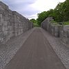
Old Erie Canal Heritage Park
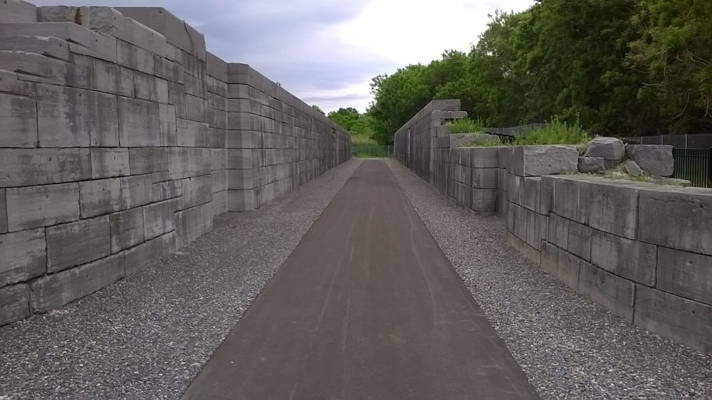
When I was a kid, my family would drive by the old Erie Canal locks that are adjacent to the New York State Thruway near Port Byron on our way to vacation in Virginia or North Carolina. Each time, I'd wish that I could get a closer look at the locks than the minivan's window. Years later, the Thruway Authority, The Canal Society of New York State, and several other state and federal agencies made that possible when they turned the abandoned locks into a park and later added a visitors center building.
The locks were No. 52 on the Enlarged Erie Canal, which stretched about 350 miles from the Hudson River north of Albany, New York, to the Buffalo harbor on Lake Erie. A sign states the locks were built in 1851 — which was during the construction of the enlarged canal that replaced the original "Clinton's Ditch" alignment — and remained in service though the early 1900s, when the canal was enlarged again and rerouted. One of the locks features an extension to accommodate raising or lowering two barges at a time.
The Thruway cuts across the former canal right-of-way to the west of the old locks, with elements of the old canal prism visible for several miles along the westbound lanes.
The locks' stonework is an impressive site, and the floor of the locks has been paved to allow visitors to walk through them. The locks' engineering isn't terribly complicated, but it's impressive that something so relatively simple was what helped drive the development of upstate New York cities like Utica, Syracuse, Rochester, and Buffalo.
There are several large informational signs with photographs that show the now mostly deserted area around the locks was once a bustling canal port, and there's more to see than just the lock structures. The visitors center located at the entrance to the park has additional information about the locks' and canal's history, and several canal-era buildings are located at the east end of the park.
The park is open May 1 to October 1 and can be accessed via the Thruway's eastbound lanes between exits 40 and 41 or via a parking area along New York Route 31 in Port Byron.

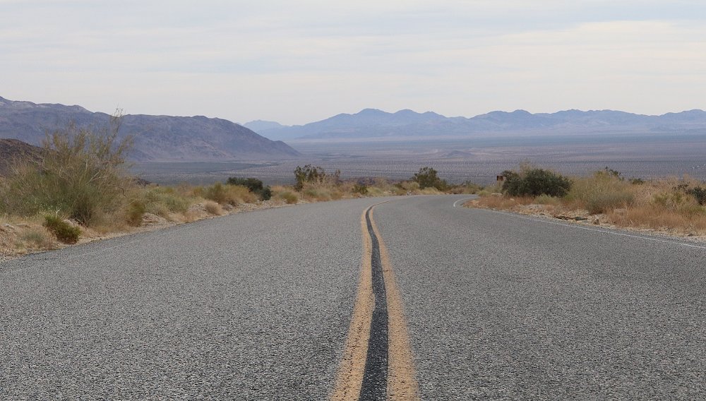
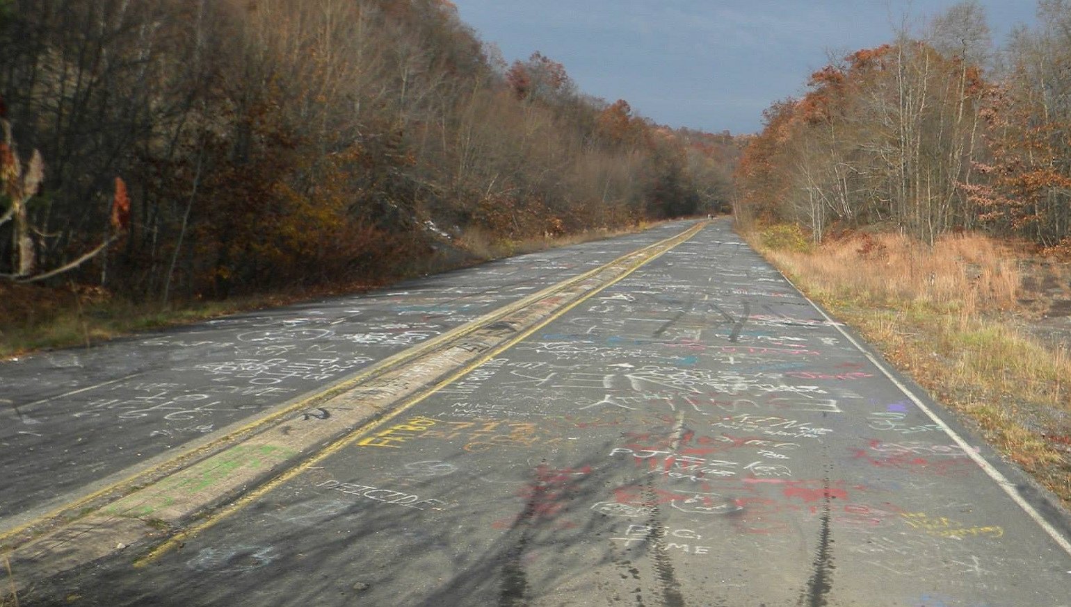
And one honorable mention for the history books: The Graffiti Highway
I have to give an honorable mention to the now-buried Graffiti Highway in Centralia, Pennsylvania. The abandoned, four-lane section of Pennsylvania Route 61 closed due to a coal mine fire that's been smoldering for decades beneath the roadway and the now-ghost town of Centralia.
Though the abandoned section was officially closed to the public — and had fissures and other signs of instability along its about 0.75-mile length — the old pavement gradually became a concrete canvas for visitors to express themselves upon with cans of spray paint. A fair amount of the graffiti I observed was perverse, silly, or nonsensical, but some of it was rather good. And, even with the not-so-great artwork, there was something special about seeing so much of it together over such a long stretch.
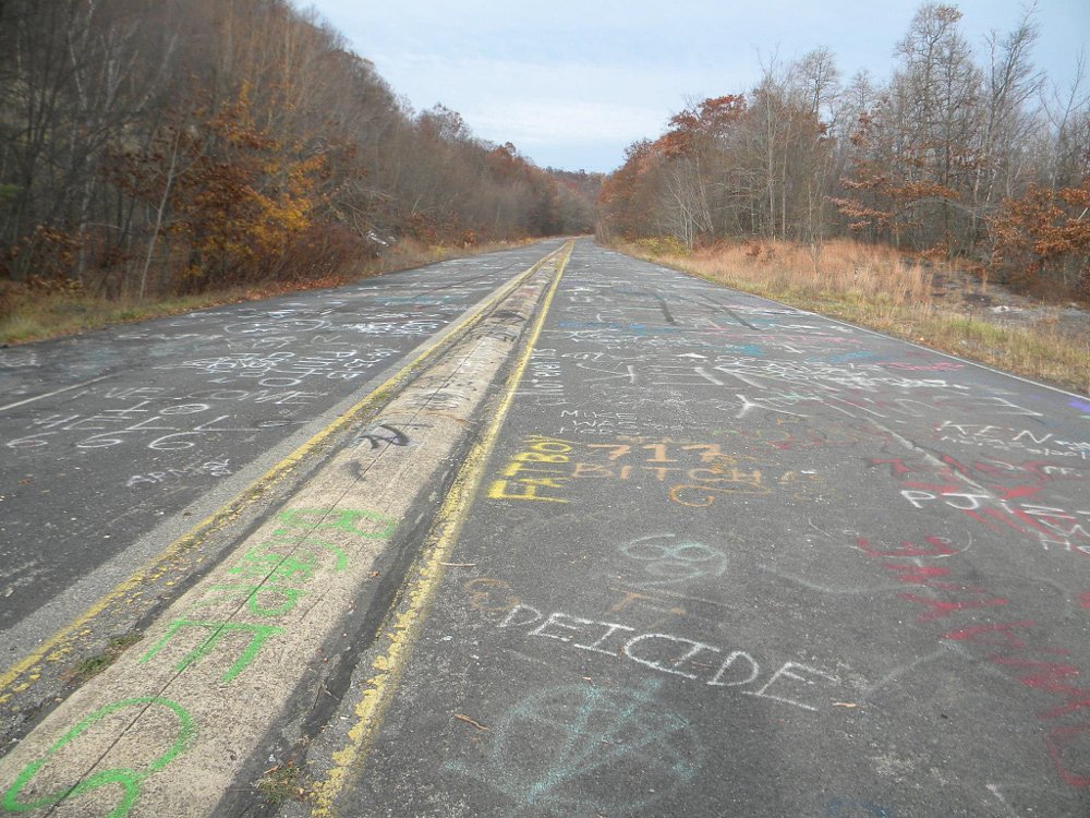
In 2020, the owner of the former roadway buried the Graffiti Highway under mounds of dirt to discourage the crowds of people who were coming to the site. The Graffiti Highway is gone.
Maybe that's a warning that we shouldn't hesitate to turn around and go back to check out that roadside oddity while we can. They may not be there forever.